


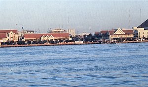
Samutprakan Province is situated at the estuary of the Chao Phraya River on the Gulf of Thailand. Commonly known as "Muang Pak Nam" Samutprakan has an area of about 1004 sq.kms., only 29 kilometers from Bangkok. It was established in the Ayudhaya Period. Today Samutprakan Province is divided into 5 Districts and (King Amphur) one sub-District: Muang District, Phrapadaeng District, Bang Phil District, Bang Bo District, Phra Samut Chedi District and Bang Soa Thong Sub-District. Its boundary is as follows:
Samut Prakan Province is situated at the very end of Chao Phraya River and on the northern part of Thai Gulf, popularized by the name of "Muang (city) Paknam", a 29 kms. distance away from Bangkok, a total area of 1,004 sq.kms. The landscape is a plain with no mountains but countless canals. Some part has flooding and sea water is at its saltiest in draught season. Most of the area are farmlands and gardens with a mixture of white mangrove forest, cycad tree, mangrove tree, nipa palm forest.