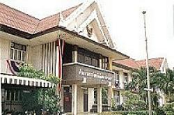

Samut
Prakran Province is situated at the very end of Chaos Phraya River
and on the northern  part of Thai Gulf,
popularized by the name of "Muang (city) Paknam", a
29 km. distance away from Bangkok, a total area of a plain with
no mountains but countless canals. Some part has flooding and
sea water is at its santies mlands and gardens with a mixture
of white mangrove forest, cycad tree, mangrove tree, nipa palm
forest. Famous products are "nipa palmand "dried fish".
Samut Prakan was built in the reign of Krung Sri - Ayudhya, its
ancient city is the area of pra pradang district called "
Nakorn Kuenkan " where foreign freighters are docked. Forts
of the city were strongly built along the sea coastal area and
later in the reign of king prabudha Lerdlah Napalai (Reign 2),
the King urged to build the city of samut prakan at the district
of Pak Nam in B.E. 2362, lasted for 3 years in construction. Then
6 forts were built along both sides of the river, namely pracone-chai
Fort. Narai Prabsuk Fort, Prakan Fort, and Pe Sua Samut Fort.